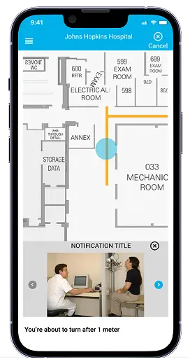
Indoor Positioning App
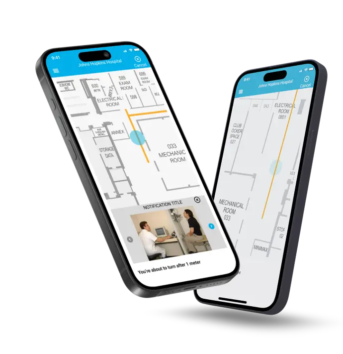
A system was created with the aid of networking devices to help users navigate inside places from their current location to a destined point of interest. This solution makes use of technology different from traditional GPS navigation. It helps in locating underground areas as well.
Country
United States of America
Service
Location Tracking Mobile App
Industry
GIS (Geographic Information System)
Build your idea
About
The Project
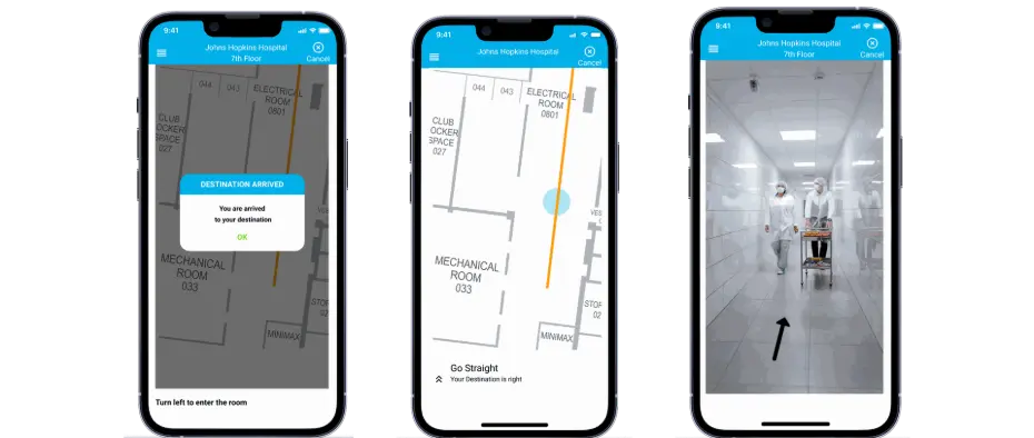
This app was developed to provide seamless indoor navigation, helping users locate points of interest (POIs) within buildings where traditional GPS fails. Our team focused on creating a robust solution that leverages Bluetooth-enabled iBeacons, server-based mapping, and advanced AR technology to accurately display user location, calculate optimal routes, and guide users via voice commands. The system addresses challenges like overlapping POIs, privacy concerns, and route recalculations, delivering a high-accuracy, user-friendly indoor positioning app for offices, malls, and large facilities.
Process We Followed
After lining up salient details related to the project, our team outlined a course of action that would be followed to develop a comprehensive solution. The process comprised of identification of problems, considering the relevant factors of the solution, taking note of common challenges faced, and coming up with the outcome in the end.
1. Problem Identification
Our team identified that traditional GPS fails for indoor navigation, making it hard to locate rooms or objects within buildings. We aimed to build a solution using iBeacons and advanced mapping to guide users from their current location to any point of interest.
3. Solution Implementation
Our team conducted extensive user research by surveying potential users to understand their pain points in indoor navigation. We analyzed existing apps, gathered feedback on missing features, and used these insights to design a precise, intuitive indoor positioning solution.
2. Feasibility Study
Our team evaluated the need for a server-based indoor mapping solution that displays POIs, calculates shortest routes, and shows the user’s current location. We incorporated voice commands and AR technology to create an accurate, user-friendly navigation experience.
4. Challenges Faced by QSS
Our team faced challenges like handling multiple SDK images, correcting user paths in real-time, managing overlapping POIs, keeping indoor maps updated, addressing privacy concerns, and ensuring accurate location tracking for seamless navigation.
5. Final Outcome Achieved
Our team delivered a native and hybrid indoor positioning app with accurate POI mapping, category-based search, accessible route navigation, seamless SDK integration, push alerts, multimedia support, and flexible route management for optimal user experience.
Problem Identification
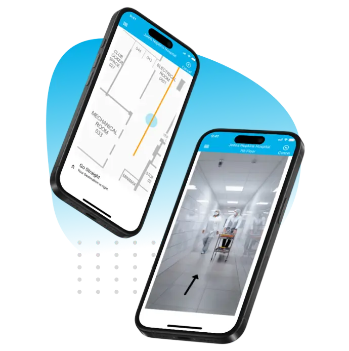
Almost everyone on earth seeks the help of GPS navigation to locate unfamiliar places. However, many often face a hard time finding areas that are in close range. Let's say a meeting room in an office. It was important to develop such an app that would be useful in locating people or objects inside buildings.
- Navigate close proximity areas in the building.
- Advance GPS navigation technology.
- Fetching location using Bluetooth-enabled iBeacon.
- Navigate from the user’s current location to a destined point of interest.
Feasibility Study
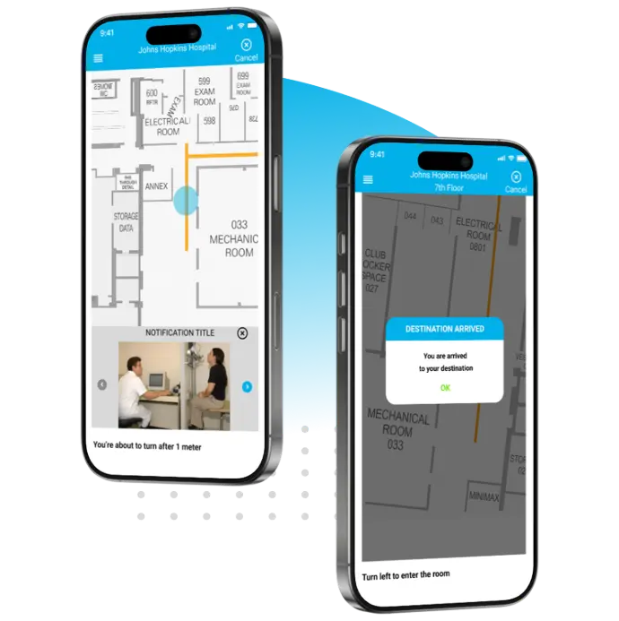
A server-based solution was required to provide users with information on POIs (points of interest) over the map on a mobile device. This map-reading technology also leads the user to navigate from their current location to a preferred POI. An elevated reality technology was called for to create a comprehensive indoor map solution.
- Showing current user location over the map inside a premise/ building.
- Implementing POI based upon categories/ subcategories.
- Creating the shortest possible route for the selected location.
- Featured voice command to direct users to the chosen destination.
Solution Implementation
With the solution framework defined, the next step was to validate our approach with real users. Understanding their navigation challenges and expectations was crucial in shaping an app that not only addressed existing gaps but also delivered a seamless indoor positioning experience.
User research
After figuring out the project requirements and solution insight, it was time to get the evaluation done by those who are going to use the application. We surveyed to get the nous of the users in which we put a question about difficulties faced by them in locating inside places. We also inquired if they have used any indoor positioning app to locate nearby places and what features they miss in those applications.
Product discovery workshop
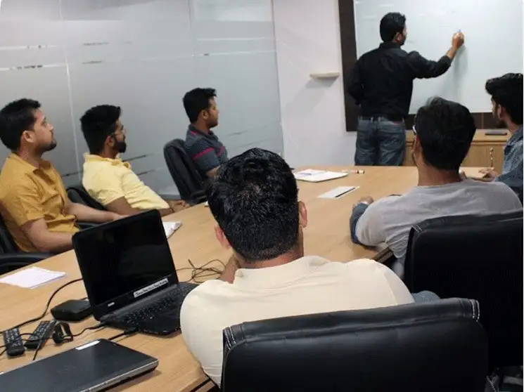
It is important to develop the solution keeping the needs of the client and target audience in mind. An application undergoes an extensive method of amassing requirements, implementation, and integration. When your customer approaches you to develop any application, there are always a few things that they ought to know. Therefore, to avoid any confusion it is better to have a pre-app-development discussion with your client.
For that, we arranged a meeting to discuss the solution with our client that mainly involved the discourse of technical manpower requirements, and features of the application and demonstrated the insight of the users we surveyed. This helped us in getting clearance if we are on the right track to develop an app that meets the expectations of the client as well as our users.
Competitor Analysis
If you are into a similar business, it becomes necessary for you to make yourself aware of the strengths and weaknesses of potential competitors. There are many software development companies that have developed inside navigating solutions and it was our accountability to figure out what those solutions lack so that we can succeed in those areas and be prominent with our product.
The Challenges
There is a flip side to everything. Where an app development is room to maneuver, it also involves many inquests, problems, and complications. This part, for developers, is known as a challenge.
- Swiping multiple images on mobile when they arrived from SDK.
- Providing a new and correct path when a user follows a wrong path.
- Identifying the current challenges of indoor LBS.
- Overlapping of POIs sometimes.
- Make availability of up-to-date indoor maps.
- To manage privacy concerns associated with location data.
Final Outcome
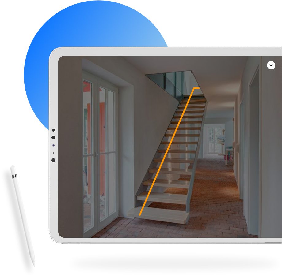
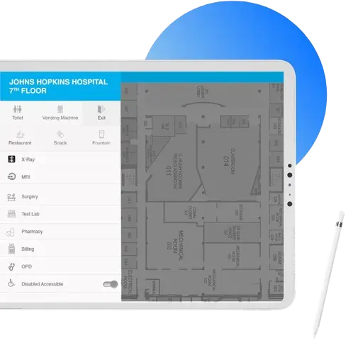
After taking good note of the other similar applications available in the market and getting the drift of the problems faced by our development team, we captured requirements, presented customers with wireframes/ static, and developed a native and hybrid indoor positioning application.
- Adding modules like displaying POIs over the map.
- Searching a POI with various filters of categories and subcategories.
- Display route navigation for differently-abled.
- Seamless integration of GUI on top of existing SDK.
- In-App Push notifications, Alerts, Images and Videos of POIs.
- High data accuracy for an end-to-end operation.
- Flexibility to cancel a route with alerts to the wrong route.
With QSS Technosoft’s expertise, our Indoor Positioning App improved navigation accuracy by 95% and reduced user search time by 70%, demonstrating why QSS delivers faster, smarter, and more reliable indoor navigation solutions than the rest.
Sample Interview Questions
- Showing location over the map inside a building
- Implementing POI based upon categories
- Creating the shortest possible route for the selected location
- Advanced map-reading technology
Bluetooth offers low-cost, energy-efficient and easy to deploy indoor positioning and tracking technology. The indoor positioning relies on Bluetooth Low Energy (BLE) beacons mounted on objects, walls, ceilings, and other places from where they emit radio signals at predetermined intervals. Devices within the emission area can then detect the signals and this helps to establish if the two (emitter and receiver) are within the range of each other.
The solution is aimed to provide users with information on POIs (point of interest) over the map on a mobile device. With this solution, we seek-
- Showing current user location over the map inside a premise/ building
- Implementing POI based upon categories/ subcategories
- Creating the shortest possible route for the selected location
- Featured voice command to direct users to the chosen destination
The idea was to develop an app that resolves the common problem of finding nearby places in users and provide them with seamless GPS navigation experience. A server-based solution was required to provide users with information on POIs (point of interest) over the map on a mobile device. This map-reading technology also leads the user to navigate from their current location to a preferred POI. An elevated reality technology was called for to create a comprehensive indoor map solution.
We used technologies- Google Maps, Swift, Java, GPS etc.
Few similar ones are- Google Indoor Map, HERE Indoor Radio Mapping, IndoorAtlas MapCreator 2, Indoorway, Path Guide, Indoor Navigation.
Technology Stack We Used
What Our client has to say!
" It is a genuine app that navigates at its best. It was difficult for me to locate the venue for my office meeting and then this application came as a savior. Love this app. "

Related Case Studies
Kickstart Your Dream Project with Us
We’ve helped industry leaders turn ideas into reality. Let’s build something extraordinary for you too.
